Ellice Island

250px-Flag_of_Tuvalu.svg

Ellice Is. gained independence from the UK on the 1st of October 1978 and anew country called Tuvalu was born.  Tuvalu means ‘eight standing together’ meaning the eight island & atolls that make up the country. There are nine islands, but at the time of independence, only eight islands were inhabited.

Tuvalu is the fourth smallest country in the world, the population of the island when I visited in 1987 was about 8,500, and the land mass of all of the islands is 26 sq Km (10 sq miles). They are a member of the Commonwealth and recognise Queen Elizabeth as the Queen of Tuvalu.

They do not have a military only a police force and a maritime surveillance vessel.
vessel

    Guardian-class HMTSS Te Mataili II (Her/ His Majesty’s Tuvaluan State Ship) for search and rescue, a gift from Australia in 2019.

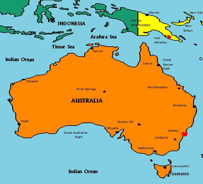
Funafuti is an atoll, and the capital of Tuvalu, and of the population 2000 of the 8500 live on this atoll. The country is not as wealthy as Kiribati.

I flew from Tarawa to Funafuti with Airline of the Marshall Island.

0011

I took the above picture after I left the aircraft after a three-and-a-half hour flight from Tarawa.
The aircraft is a HS748, which first flew in June 1960!
It was a memorable flight because as we approached Funafuti to land the door between the flight deck and the passengers flew open. From my seat I was able to watch a very low island come clearer.
It was then that I realised that we were going to land on a grass strip, which at the time was being used as a football pitch by two teams and a large number of spectators.
As we got closer, I saw one of the players pick up the ball and run to the touchline to watch us land.

The aircraft came to a halt near a concrete structure – the arrival terminus.

004

002

Local people milled around on both sides of the ‘security area’, some helping to unload the cargo from the plane, others had just come to see what was happening as part of the day’s entertainment. The sun was hot and nobody moved at any great pace – I was on island time, and I should relax.003

I was the only passenger to leave the aircraft, so I had the undivided attention of everyone.
An officer, in traditional island dress of sandals, and lungi tied at the waist, and a uniform shirt stood waiting at one side of a concrete table with a stamp and an ink pad. I was welcomed to Tuvalu and my passport was stamped.

Customs asked if I had anything to declare – I said No and was waved through the concrete area to a grass patch outside the open walled government building.

I anticipated that my business would not take more than a few hours, but due to flight schedules I was going to be ‘island bound’ over the weekend. I’d arrived on a Saturday and booked my onward ticket to Fiji for Monday.
I looked around for an airline employee to confirm my onward flight and found a young lady in a island skirt and an airline type blouse. I asked her if I could confirm my flight for Monday – she looked at me and asked if I was Woodland, the business man from Sydney?
I confirmed that I was, and she then told me that as I was the only person who wished to go to Fiji on Monday, they were not going to bring a plane in just for me – I was told to come back on Wednesday!

Tuvalu did not have a taxi service, so I started to walk to the hotel, which fortunately was only a couple of minutes from the ‘airport’.

vl2b
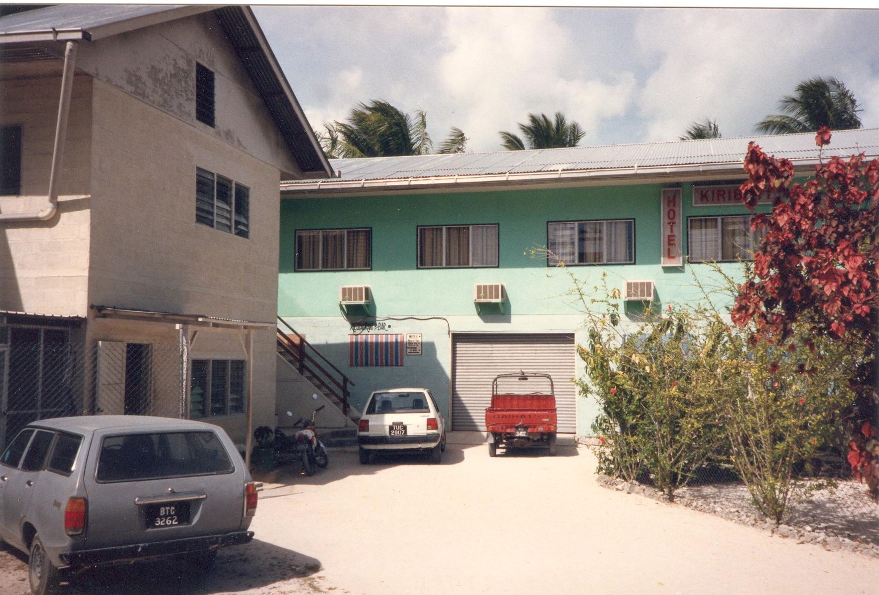
The Vaiaku Lagi Hotel, was government run and the only hotel on the island so I checked-in and was given a room overlooking the lagoon; it was air-conditioned!

view_from_hotel_room

I doubt that this view would have changed much – this the view is across the lagoon from my room.

Later I found out that most of the rooms did not have air-conditioning, which would be a problem for Europeans.
The only other guest was a Japanese merchant seaman waiting for his ship to return. He’d been put ashore for medical treatment.
He couldn’t speak English, and most of my Japanese, picked up during my time on the Japanese coast, had faded into history. He did teach me how to play Othello and I liked it so much that I bought the game for my children on my return to Sydney.

Othello

The person I was to meet was on another island and would not be back until the following morning.

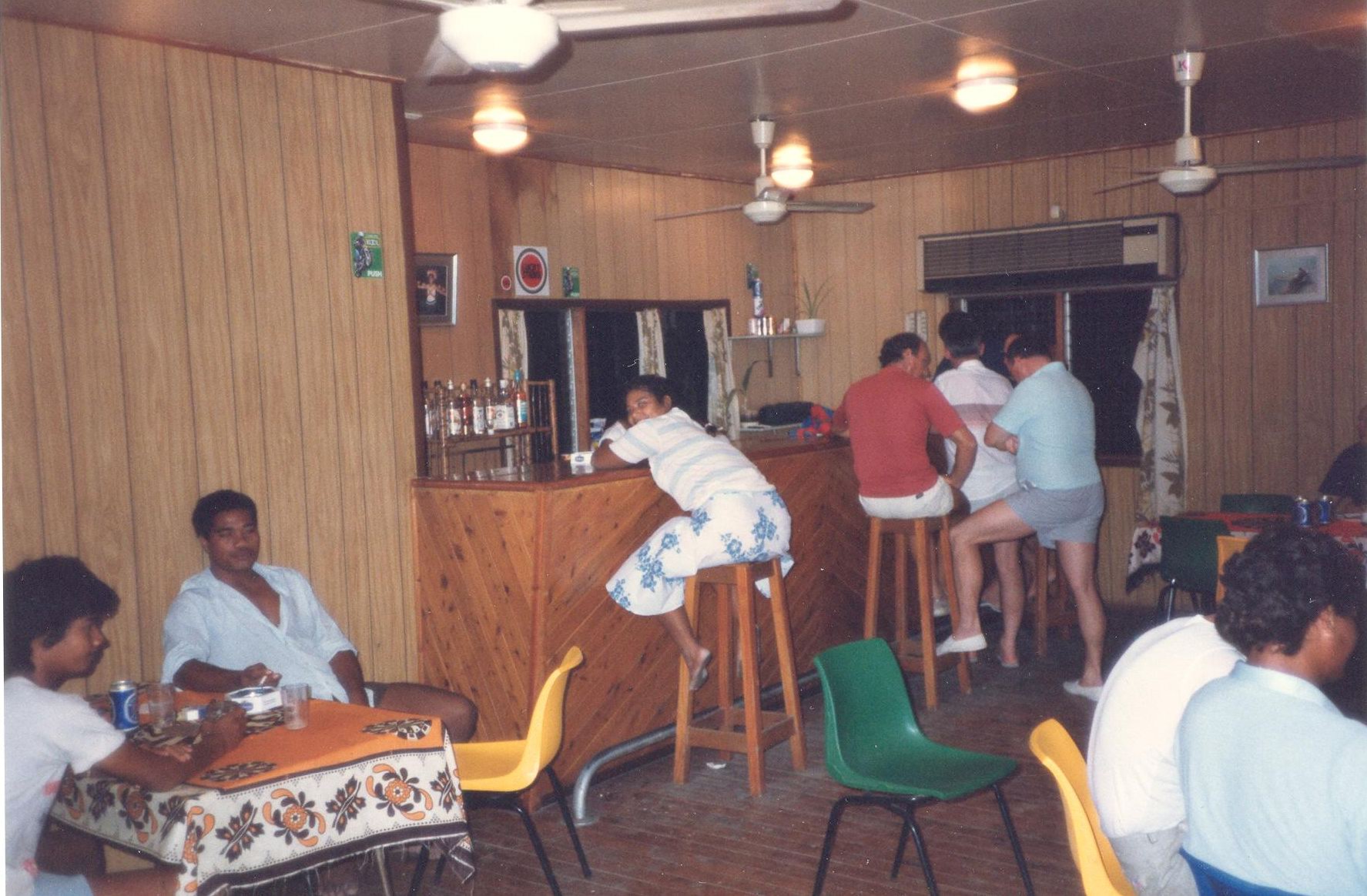
After unpacking my few things I made my way to the bar and asked the barman, who was also the  check-in / doorman / waiter and I am not sure what else, what type of cold beer did the hotel stock. ‘We have Fosters’ was the reply – ‘What other kind of beer?’ I asked not being a great fan of Fosters beer.jpg – ‘We have Fosters’ was his reply at which point he opened the door of a very large walk-in fridge behind the counter, allowing me to see that the fridge was stacked high with cartons of Fosters beer and nothing else. ‘I’ll have a Fosters!’ I said with a smile on my face.
‘Supply ship just unloaded the other day, plenty of Fosters’ was his comment while pouring the glass of cold beer. At times like this, Foster’s was the nectar of the Gods.

In the evening I decided to stay in the hotel for my evening meal. The hotel didn’t have a menu, the Japanese and I were asked what we would like to eat.

I asked what the choice was and was told fish or meat. I asked if the fish was fresh and was told that it had arrived in the morning, so I chose the fish. The meat on offer was a mixture of chicken (locally grown) and meat from Australia, which was expensive.

I asked for salad with the fish and was told that they didn’t have any, just vegetables – so I ordered the vegetables which, when they arrived turned out to be from a tin – I was hoping in such a lush climate to have fresh vegetables. Let’s say it was a disappointment.
I asked if they had any cold white wine to go with the fish – ‘We have Fosters’ was the reply.

Later in the evening while listening to the radio in the bar, I heard the news, and included in the news was the fact that a businessman from Sydney had arrived that afternoon. Was this my fifteen minutes of fame, or was the radio station hard up to fill broadcasting time?

I completed my business the following morning and decided after lunch to have a look around Funafuti.

Knowing that there wouldn’t be any aircraft landing between Saturday afternoon and Wednesday and noticing that the immigration and customs posted had been abandoned, I walked across the football pitch, come runway, to the other side of the island. I passed huts inside a fenced area and wondered what this area was because the gate was wide open.

prison

It was later when I found out that the gated area was the local prison. The above picture is a recent photograph. I did ask why the gate was open and was told – ‘Where are the prisoners going to escape to?’. . .

On reaching the water’s edge (the opposite side of the island from the lagoon) I watched Pacific Ocean rollers charging towards the little island and smashing their way on to huge man-made blocks, which dissipated their energy. I was grateful for the blocks, because the highest point on the island was only 4.5 mtrs (15 feet) above sea level.

sea

Everything shut down late Saturday and the only entertainment for me was sitting in the hotel bar with a book and the occasional game of Othello. Trying to get through to Sydney by phone, to keep them informed of my movements, helped pass the time. The fact that they had no idea that I was not lying on a beach in a fancy beach side resort somewhere in the tropics, didn’t help matters.

Sunday was a drag but there was a small distraction when the flight that I had arrived on transited Funafuti (the airline code being FUN!) on its way back to the Marshall Islands. The travel shop was open as was the basket shop for transit passengers . . . . I borrowed an umbrella due to the heavy rain any distraction was valuable.
Monday arrived and the post office opened at 10.00 am because I was interested in stamps, and at that time I collected stamps from certain Pacific Islands. It turned out that philatelists are one of the best contributors to the Tuvaluan economy, along with cash sent home by Tuvaluan seaman working on foreign ships.
The next thing I did was join the Tuvaluan library, and I think I might still be a member

stamps

The enforced rest can be a strain knowing that all your plans have been shot to pieces and communication with the outside world was difficult.
E-mailing was still in the future, as was the mobile phone.

But overall I enjoyed my enforced rest in Tuvalu, because it was completely different place than anywhere else that I had visited.

Tarawa

8 inch British coastal guns 001

Two days after Pearl Harbour the Japanese attacked and captured Tarawa in December 1941.

007

The island became a fortress, buildings were knocked down and all the palm trees removed. The local population became slaves and were forced to create bunkers, an airstrip and concrete structures with metal spikes concreted into the coral reefs around the atoll, all fishing boats were destroyed along with any other form of boat or canoe etc .
Once everything was completed the local population were forced to leave the atoll and they had to walk up to 25 miles across coral reefs to the northern area of the atoll.
During my trip to Tarawa in the 1980’s I saw eight-inch guns still point out to sea. I was told (not by locals) that the guns had been removed from Singapore, after the fall of that island, and transported to the Pacific to defend Tarawa. Later I read that the Imperial War Museum in London stated that Singapore didn’t have any eight inch guns for the Japanese to capture, so they couldn’t have been transferred to Tarawa from Singapore.
They were in fact manufactured in Britain for a contract to supply eight inch and twelve inch guns to the Japanese navy for the Japan – Russian war of 1904-1905.
The Tarawa defensive guns appear to have been part of this contract.

The old bomber strip 001

The Japanese airstrip when I visited Tarawa. The trees had returned, but the actual landing strip was causing problems for even the grass to grow.

Tarawa was the most heavily defended atoll that the Americans would attack in WW2.
The Americans had to estimate how many troops were defending the atoll. The best guess was about 3100 men, which was reasonably accurate, considering that they were unable to send in reconnaissance units to obtain a more accurate number. The Americans realised from aerial photographs, that the Japanese built their latrines over water, in multi-holed wooden buildings. By counting the number of latrines, they worked out the relationship between the number of backsides to a latrine and estimated 3100 troops!

The Japanese commander (Admiral Shibazaki) said that the Americans could not take Tarawa with a million men in a hundred years.
With 100 pillboxes, concrete bunkers, anti-aircraft guns, coral shallow reefs ring with barbed wire and mines plus entrenched machine guns manned by 4500 Japanese troops, it is not surprising that the Japanese commander made such a comment.

Shibazaki

Rear Admiral Keiji Shibazaki (9th April 1894-20 November 1943)  

When the Americans arrived off Tarawa and sent off the first wave of troops there were problems – the tide was lower than expected and some of the landing craft and amphibious tanks became stuck on coral reefs within range of the Japanese’s guns. Some of the invading troops left the ‘security’ of the landing craft and waded hundreds of yards to the beach under constant fire from the Japanese. 

War and beach 001

As I walked along the shoreline, I could see the remains of landing craft and aircraft at low tide. It was during the 20th to the 23rd of November 1943 that the Battle of Tarawa was fought between the Americans and the Japanese.

Stranded 001

I walked out to the remains and looking back at the beach and thought  is it any wonder the Americans lost so many. On the third day of the battle the tide was higher, which allowed destroyers to get close in and pinpoint the enemy.

The battle lasted 76 hours and in the final hours the Japanese launched a banzai attack. When the battle finished of the 4500 Japanese defenders only 17 remained alive.

The Americans lost more than 1113 dead and 2290 wounded of their 18,000 attacking force in the three day-battle.
They lost nearly as many killed-in-action during the three days of the battle for Tarawa, as they lost in six months when taking Guadalcanal Island. 

Inside a Japanese pillbox 001

Inside a Japanese pillbox near the beach.

Japanese HQ bomb shelter 001

Japanese HQ

003

The above pictures show the Japanese HQ building with shell and machine gun damage, which when I visited was being used a simple squash court.

Tarawa_aerial_view_24_Nov_1943

What the area looked like on the 24th of November 1943, the day after the battle.
I walked along the same beach 44 years later – Tarawa Atoll (the area in question) is 3.2 km (2 miles) long and the narrow bit is 730 mts (800 yards) at the widest point.  
The link below is a six-minute piece of colour film of the landing.

The landing


Gilbert Islands

400px-GilbertIslandsPos

In 1788 Thomas Gilbert was the Captain of the Charlotte, which had sailed to Australia as part of the first fleet carrying convicts.
After discharging his convict passengers Captain Gilbert sailed for China and passed through a group of islands that we now know as The Gilbert Islands.
He made sketches of the islands and named Tarawa (marked with green above), Mathew Island after the owner of his ship. He also named the large lagoon Charlotte Bay after his ship. Fortunately his sketches have survived.

lagoon

The lagoon . . .a beautiful spot.


He did obtain a cargo for the East India Company and sailed back to England.

nr-02

South of Nauru you can see an island called Kiribati, which is the new name for Gilbert Island. Kiribati (pro Ki-ri-bass), which is how they pronounced Gilbert in their own language (Gilbertese). 

Kiribati consists of a thirty-three islands with a land mass of 803 sq km (310 sq miles) but spread across 5,180,000 sq km (2million square miles) of ocean. Tarawa, the atoll where I landed, is 208 km (80 miles) north of the Equator, which was home to about 2000 people, or one third of the total population of Kiribati.
Of this total, about 300 were Europeans mainly British, Australian & Kiwis mostly employed as ‘advisors’.
The people were big in to ‘Manyana’, but done very politely.  

The height of the land above the sea was about 2.5 mtrs (8 feet), fortunately the weather was fine.   

airport

Tarawa airport 001

arrival hall

Tarawa arrival Hall was quiet . . . 

The flight from Nauru was not a long flight but when I stepped out of the aircraft the heat hit me. Above is the passenger terminal and arrival hall, where I was met by our agent Kenton, who was the British Government advisor to the Kiribati Co-Op Wholesale Society, thankfully shortened to KCWS, but known locally as K-C.
He took me to a hotel in Batio, (pro Bay-she-oh), which is the capital on the main atoll of Tarawa.

Hotel 001

My hotel is the green building.

Room

room2

After the empty suite in Nauru my room in Batio was small . . . . the white door with the red knob was the bathroom door.

I switched on the air-conditioning unit in the hope that it would cool the place down – the agent and I had agreed that he would show me around in the morning – he said that it would be cooler. I only hoped that I would not fade away with heat stroke in the meantime.

I tried to cool off in the shower, but the water pressure was not all the at good, so I sat in the bar, which was the coolest place in the hotel. At that time, they did not have their own beer but imported Australian beer, I did not care as long as it was cold.

Reception 001

The drinks were cold, and the people were friendly, and the tuna fish was fresh.
During one conversation when ordering a beer I did ask about the strange patterns on the wooden floor. Apparently, they were ‘argument’ patterns – a few beers and a wrong word and it was fight time with bottles and knives.

They did not have TV and the radio only broadcast for three hours a day.

I went to bed early.

Next morning at breakfast I picked up the menu – it was the same one from the previous evening. I realised that the menu was not for choosing anything, but to read and be aware of what you might not receive, because the food was reliant on what had arrived from Australia or New Zealand in the last week or so. The one thing that was super fresh was the fish, all locally caught, but most other foods came from overseas.

I commented to the young lady who wanted to know what I wanted for breakfast, that the pattern had changed on the floorboards. She shrugged and said, ‘They fight’, and then asked what I would like for breakfast as if the blood stains were normal, which I suppose they were.

I asked for black coffee, toast, and marmalade.
‘Marmalade is Off’ she said.
‘What kind of jam do you have’, I asked.
‘We have jam jam and we have marmalade jam.’
‘I would like toast and marmalade jam, please.’
‘OK’ she said, everything was very proper and it was hard to keep a straight face.

agent

Kenton arrived on time and I was given the Cook’s tour of the atoll.

Local bank in Batio 001

Tarawa 002

It was a mixture of traditional and modern, but interesting and as English is the national language I could ask as many questions as I liked.

Graves 001

Near the old WW2 airstrip, I was shown a local cemetery. The depth of the soil is very shallow and to mark a grave they would use old beer bottles.
beer bottles
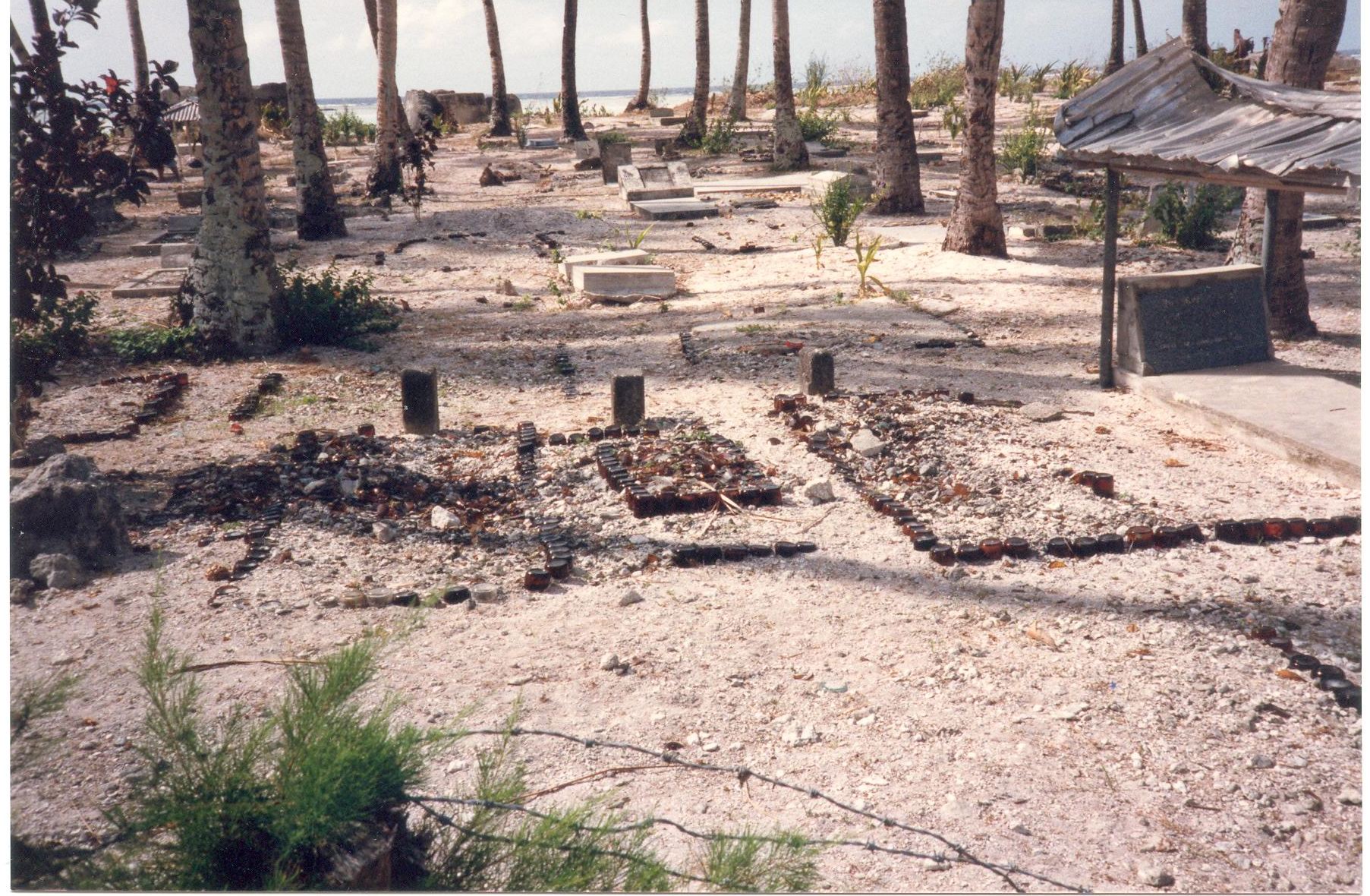
Above is a closeup of one of the graves. office

KC imported basic foods and general items, mainly by sea, and then they would supply the various shop who were members of the Co-Operative.  

I knew that our agent would not survive on our traffic alone – it was just a sideline for him – but it was a pleasure to see our company name SKYPAK displayed prominently, and he wanted more stickers & signs.
The people in the above picture worked for KC.

The main problem that I had was communicating with Kiribati from Sydney – Kiribati was not linked via ISD so if I wished to speak to Kenton I had to go through an operator. . . which sometimes was very time consuming. 

flag

The flag of Kiribati

The flag of Kiribati is red in the upper half with a gold frigate flying over a gold rising sun, and the lower half is blue with three horizontal wavy white stripes to represent the ocean and the three island groups, Gilbert, Phoenix and Line Islands.
The 17 rays of the sun represent the 16 Gilbert Islands and Banaba Island, which used to be called Ocean Island.

Next stop Ellice Is. now called Tuvalu = Eight standing together . . . 


Nauru

Nauru-location-on-a-map

The red symbol is Nauru

Air Nauru

My next trip was to review our delivery agency in Nauru and two other Pacific Islands.

To get to the other two islands I had to travel via Nauru, which under normal circumstances would not be a problem except that the Air Nauru service from Australia to Nauru was ‘intermittent’.
One of the problems being that if the President of Nauru wished to visit another country he would ‘borrow’ an Air Nauru aircraft, which was a problem for the airline because they only had three B737/200’s with the capacity to fly to Australia. Allowing for maintenance and the service to Brisbane, Melbourne, and Sydney the removal of an aircraft to satisfy the President created a huge problem.
In 1983 they had two B727s and five B737/200’s so Air Nauru at that time, had enough seating capacity to carry 10% of the total population of Nauru.
The size of the population at the time was about 8000, living on an island that is 21 sq km (eight square miles).

Nauru-map

The country of Nauru became the 187th member of the UN in 1999 and is the smallest island nation in the world and the third smallest country, after the Vatican & Monaco. Nauru is also in the Commonwealth.

The country has been inhabited for about 3000 years, the people arriving from Polynesia and Micronesia.

Pacific_Culture_Areas

There are three main cultural areas in the Pacific – Micronesia, Polynesia, and Melanesia.  

Nauru’s first contact with Europeans was in 1798 when the British whaling vessel Hunter called at the island and the captain of the Hunter was so impressed with the natives and the island that he named the island Pleasant Island. The island retained this name for ninety years until the Germans arrived and annexed the island in 1888.

150px-Flag_of_Nauru.svg

The flag of Nauru and the star has twelve points represent the original 12 tribes who lived on Pleasant Island.

The island was incorporated into German New Guinea and renamed Nawodo or Onawero. The island was a lush paradise at the time.

During a visit to the island by a cargo ship in 1896, the cargo officer found a strange looking rock that he thought was petrified wood. He picked up the rock and took it back to Sydney and used it as a door stop.

Banaba_door_stop

The actual door stop

In 1899 Albert Ellis, who worked for the phosphate division of the same
company as the cargo officer, was visiting the Sydney office and saw the door stop and commented that it was phosphate, but the cargo officer insisted that it was wood.

Some weeks later Albert Ellis tested the ‘wooden’ rock and found that it was high grade phosphate. The discovery generated great interest and a company called Pacific Phosphate was created.

In 1906 the right to mine was obtained and after WW1 the right to mine was obtained by the British Phosphate Commission, which was created by the UK, Australia, and New Zealand.

During WW1 Australia captured Nauru from Germany and mechanized the mining. 

The Japanese captured the island in WW2 and at the end of WW2 the UN put the island under trustee of the UK, Australia, and New Zealand.

In 1968 Nauru gained independence and by 1968 one third of Nauru had been stripped mined.
The mining of phosphate by 1975 made the Nauruan people extraordinarily rich and only the people of Saudi Arabia were richer. The Royalties Trust for the Nauru people was worth over one Billion USD.
The government did not levy income tax, education was free, as was the health care and most people worked for the government – immigrants worked the mines.

The profits from the mining went into a trust fund for the people and they did invest profitably at times. In 1988 the Trust bought 600 acres (2.4 sq km) of land near Portland, Oregon and sold allotments to the locals to build their homes, once 75% of the allotments had been sold the homeowners took over control.

In 1977 Nauru Trust built Nauru House in Melbourne, 52 floors and 183 mtrs (600 feet) tall.

800px-Nauru_house     Nauru House, or 80 Collins Street Melbourne, which is still owned by the people of Nauru. It was the tallest building in Melbourne at the time, but only for a year.

When I arrived in Nauru in the 1980’s I was met by our agent who had booked me in to the best hotel, or so he said, and I had a suite.

540171_388089211216388_120484265_n

It was called Menen Hotel and at the time I think it was the only hotel, so the agent was not lying.

menen-hotel-pool

The above two pictures are off the internet and were taken recently, but I do not see any change than when I was there 35 years ago – the pool is still empty.

st 01

Part of my suite – the shirt over the stool is mine and the stools are at the bar.

st02The bar was dry as a bone, and you can just see the bedroom on the right.

During the night I was woken by a strange sound as if someone were scratching on the main door of the suite.
I went to investigate only to find large crabs in the hallway and a couple were scratching at my door trying to get in . . . I kicked them back from the door and saw quite a few ‘walking’ down the corridor. I shut the suite door quickly and tried to get back to sleep-crabs are not my favourite idea of a pet or as a meal. Continue reading “Nauru”

Coffee Country

Flag

Papua New Guinea’s flag.

After my trip to Singapore and the other Asian offices I was asked to visit our next-door neighbour Papua New Guinea, because TNT had offices in this country and we planned to use these inter-company connections as our agent for courier traffic.
This was the start of my Pacific Island-hopping time.

australia-oceania-map

The map shows Australia and Papua New Guinea – the red dot on the Australia is Sydney and the red dot on the yellow area, which is PNG, is the capital Port Moresby.

It is thought that people have lived in PNG for over 60,000 years and it was not until the Portuguese and Spanish arrived in the 16th century that the first Europeans took notice of the area around PNG.

Jorge de Menezes, a Portuguese explorer arrived in about 1526 and is thought to have named the people ‘Papua’, which is a Malay word for frizzy hair of the local people.

Later, about 1545 the Spanish arrived and named the area New Guinea because they considered that the locals reminded them of the natives of West Africa around Guinea.

Over the years various Europeans have navigated around what we now know as PNG and in the 1870’s a Russian Nicholai Miklukho-Maklai arrived and lived with the locals for some years.

Miklukho-Maklai

Nicholai Miklukho-Maklai

He does not look all that happy, perhaps he is thinking of returning to a Russian winter.

In 1883 the colony of Queensland tried to annex part of PNG, but the British Government did not approve until Germany took an interest and started settlements in the northern areas of PNG, at which time the British, in 1884, declared the southern area of Papua New Guinea a British protectorate.
It was called British New Guinea, which, in 1902 was placed under the control of Australia, and remained so until independent in 1975, except for four years when the northern part was under the control of the Japanese (1941 -45).

At the beginning of WW1 Australian troops took control of German New Guinea until the end of the war.
In 1921 the League of Nations gave Australia a mandate to govern the ex- German territory and Australia did so until independence.

I found PNG to be a fascinating place and the staff at the main TNT office in Port Moresby were very hospitable and full of local knowledge.

I love odd bits of trivia – such as – in PNG until 1933 seashells were used as the local currency.

hooded-pitohui

PNG has the only poisonous bird in the world – the   Hooded Pitohui

Port Moresby_article

and on a brighter note – Port Moresby the capital, I know it has had troubles in the recent past but in the late 1980’s it was peaceful and a friendly place.

I was only in POM (the code for Port Moresby airport) for a couple of days and it was a ‘getting to know’ you trip, rather than a hard business trip of negotiations for maximising profit.

On leaving I was presented with a large carton of Papua New Guinea coffee. In the carton were small solid bricks of vacuumed packed ground coffee, and until I visited Papua New Guinea I had not tried PNG coffee.

From memory I am sure it was Goroka coffee, but the packaging was not as fancy in the late 80’s. Goroka is an area in the Eastern Highlands.

OLYMPUS DIGITAL CAMERA

Try this link for Black Coffee if you like

Black coffee

 A blast from the past . .